Addressing

VIDEO DISCUSSION (Mobile Version) available here.
Addressing allows entry of two sorts of Address data: Defaults and the Congregation's
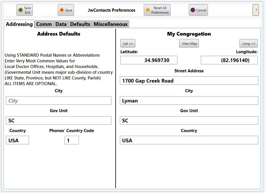
Address Defaults: To save time entering portions of addresses likely to be repeated very frequently,
you can here enter values to be automatically inserted each time an Entity with an address is created.
You should use the most common postal names or abbreviations, as they will be used as part of generating a map from an address.
You can always adjust any of these auto-inserted values if they do not apply to a specific Entity.
Please make any appropriate entries BEFORE importing data.
If your territory includes several cities (villages, towns, etc.) just leave City set to its prompt, "City", entering nothing.
Note: Make sure you spell all entries correctly, as they may be used to generate maps.
Governmental Unit means that named portion of an address that generally precedes a Country, such as a State or Province, NOT a County or Parish.
Both Governmental Unit and Country may be abbreviated using the MOST COMMON postal abbreviations, as understood by mapping apps.
Do NOT include periods or spaces unless these are commonly used in mapping.
For the United States of America, USA is preferred over the shorter US.
To Support Internet Texting "Phones' Country Code" is now required; Normal Imports cannot be undertaken until supplied.
My Congregation: Only the Latitude and Longitude are currently used elsewhere within JwC.
They are required by the Households Reports, as these show distance and bearing from the Congregation's Meeting Place.
You can manually supply these values or, if you are at that location, use From Here to determine latitude and longitude..
Some keyboards make entry of a leading negative sign difficult; Resolve that by instead using the Sign Reversal buttons as necessary.
Then use View Map to verify the right values have been entered. This button is disabled until both Latitude and Longitude have been entered. See Maps.